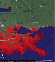
 Here is a map produced by the department of Geosciences at the University of Arizona showing how the coastline of South East Louisiana would change should the sea level rise by one meter. Notice that the most populated areas of the state are now under water! It is estimated that the sea level could rise one meter by the end of this century. Another map shows that the southern third of Florida would be inundated for the same one meter of sea level rise.
No comments:
Post a Comment